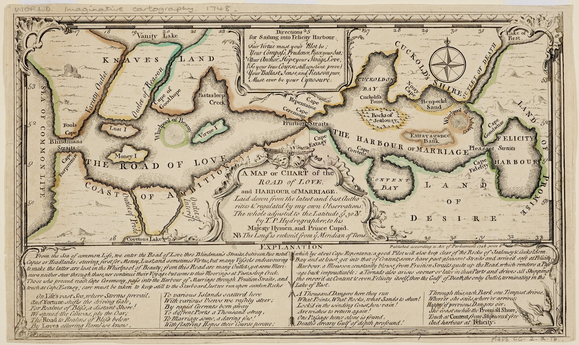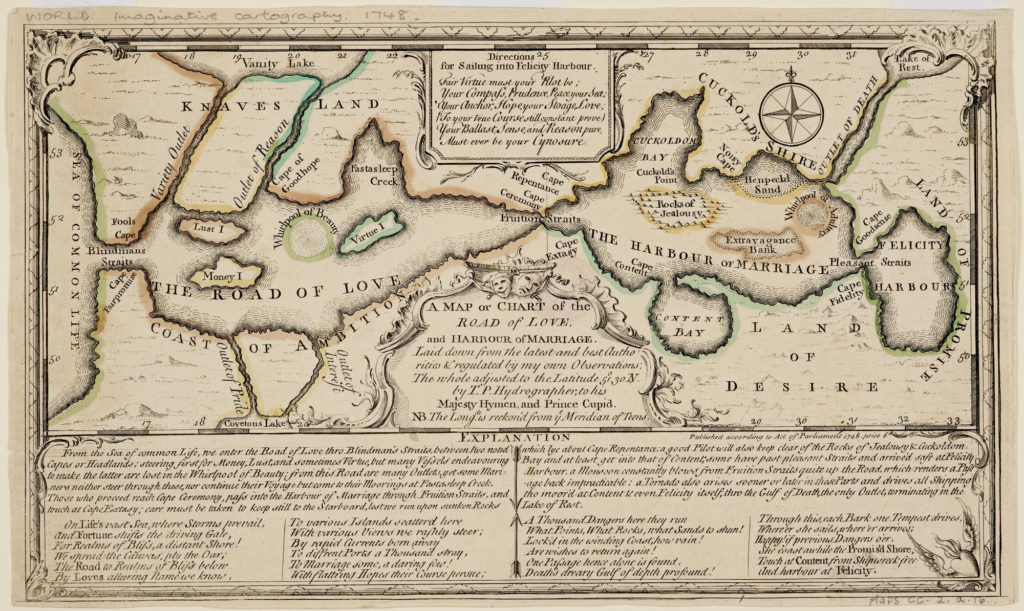
A Map or Chart of the Road of Love, and Harbour of Marriage (1748) by “T. P. Hydrographer; to his Majesty Hymen and Prince Cupid,” one of the very many maps clearly reproduced in this fourth volume of the University of Chicago Press’s History of Cartography, offers guidance to such hazards as the Whirlpools of Beauty and Adultery, the Rocks of Jealousy, and Extravagance Bank. The Land of Desire sits opposite Cuckold’s Shire. The scholarly text that the editors attach to this map draws attention to the contrast between this and the French Carte de l’isle du mariage (1732), which has marriage as an island. In the British map from 1748, it is presented in a more benign light, with “Content Bay” and “Felicity Harbour” leading off from it.
All maps are here. The value of The History of Cartographyto those interested in maps has long been a given, and one further affirmed by the project’s scale, which is unlikely to be matched. The importance of an understanding of maps to broader intellectual, cultural, and political currents emerges clearly, as does the very delight of maps. Indeed, as an aesthetic product, the two “parts,” each substantial volumes themselves, of this one “volume,” with the total weight almost sixteen pounds, are a triumph. As your reviewer, I have read it cover to cover, but you, dear reader, can follow the helpful and clear organization by entries, or, alternatively, just browse at random. You will find not only